Richard L. Wood, a University of Nebraska–Lincoln civil engineering assistant professor who specializes in disaster damage, has turned his expertise toward the Bahamas in an effort to understand why some buildings survived Hurricane Dorian’s onslaught in early September.
More than 60 people died and many others remain missing following what’s been reported as the strongest hurricane on record to make landfall in the Atlantic Ocean basin. Wind speeds were reported at 185 mph.
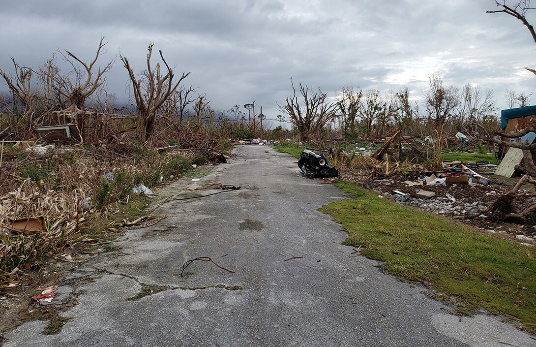
Wood recently spent five days surveying damage in a National Science Foundation-supported trip to Grand Bahama Island and Sweetings Cay on the northwest side of the archipelago. Authorities reported that more than three-fourths of homes in this area were destroyed by the storm.
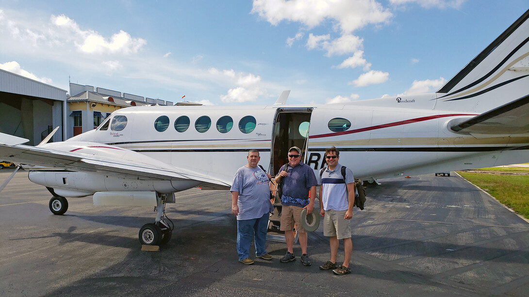
Wood led a three-person rapid imaging team that visited the area in early October, just over a month after the hurricane winds and storm surge struck the region. The island was still reeling from the devastating storm, he said
“The goal was to examine the severity and distribution of damage following the hurricane as a result of the wind and storm surge,” he said. “It was intense.”
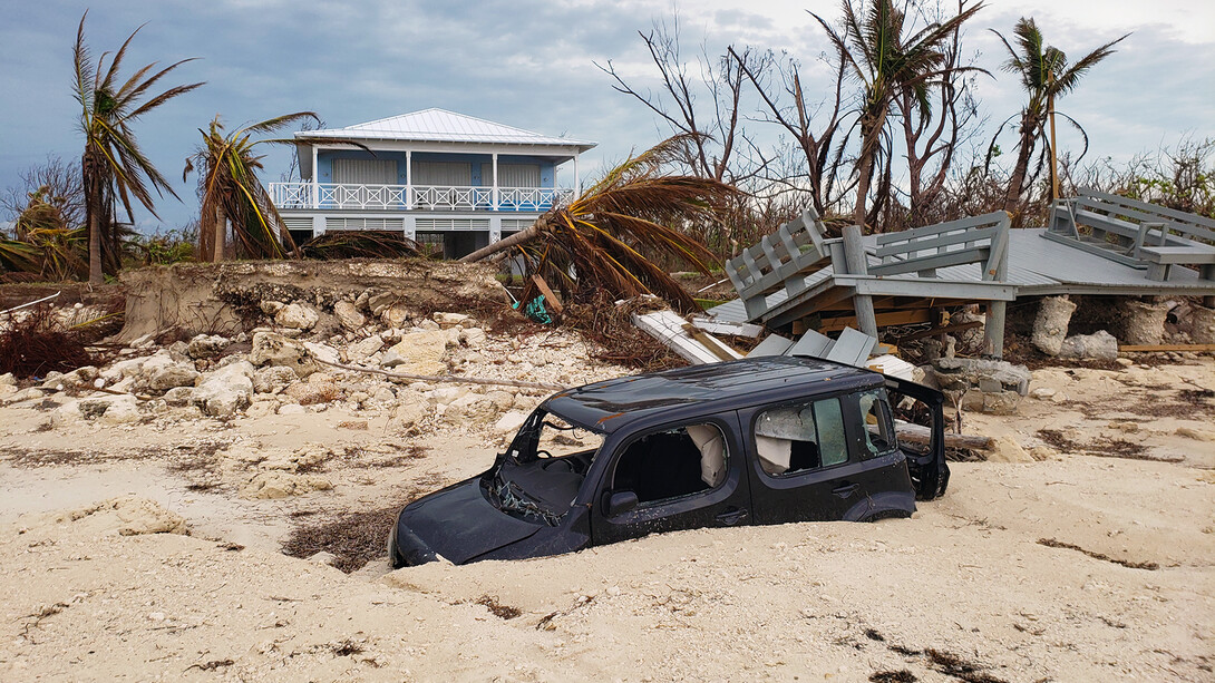
Although Wood has previously visited the sites of tornadoes, hurricanes, and earthquakes for his disaster-related research, he said he had never seen damage at the scale he witnessed in the Bahamas.
Other members of Wood’s team included Henry Lester, a civil engineering and systems engineering assistant professor from the University of South Alabama, and Mike Vorce, a consultant and president with Site Tour 360. The team’s primary goal was to document the contours of damage severity, based on the path of the storm, topography and construction styles.
Wood’s research trip was organized by Structural Extreme Events Reconnaissance, a network formed in 2018 to gather data about global disasters in near real-time. Its mandate is to collect perishable data swiftly and systematically for subsequent use. The network is led by engineers from the University of Notre Dame, the University of Florida, the University of California, Berkeley, the University of Hawaii, Manoa, and Auburn University.
Wood’s team was part of a larger deployment of engineers sent to the Bahamas Oct. 5-8. Other researchers conducted a coastal survey and a door-to-door damage assessment, with a focus on Abaco Island and its nearby cays.
Wood used lidar, a surveying method that uses laser pulses to measure distance to analyze structures, including a church and homes at Sweetings Cay, and a university building, communications tower, bridge, and homes throughout Freeport and the Grand Bahama Island. The team also deployed street-view cameras to collect perishable imagery throughout the islands.
“Buildings were selected in the field,” he said. “It’s really for forensic studies on wind and surge damage. It creates the ability to more reliably estimate the height of storm surge and the resistance of the buildings.”
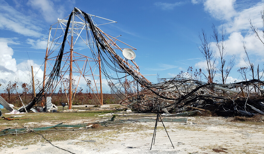
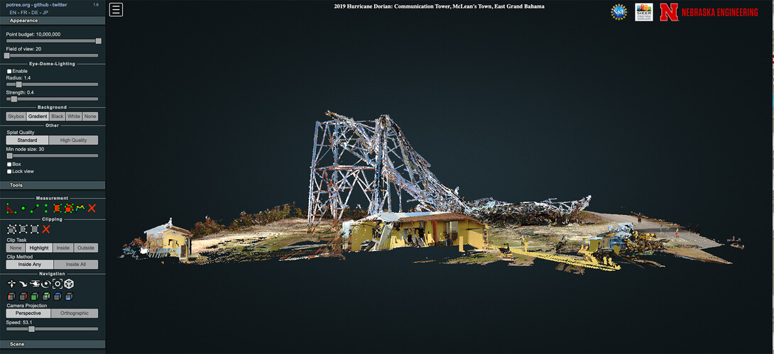
Although Wood often uses drones to help him assess disaster-related damage, he left his drones behind on this trip. The Bahamian government had barred their use in the disaster area, likely for humanitarian reasons.
The damage he found was sometimes surprising, particularly success stories in the areas of extreme devastation.
The church at Sweetings Cay, for example, was completely inundated with water as a result of an 18-foot high storm surge – yet its hurricane shutters prevented significant wind damage. It remained enough intact that it was being used as a relief center.
Some homes remained standing but inaccessible because the beach had severely eroded away from their foundations. Other houses had fallen off their foundations as a result of more than 12 feet of erosion scouring at the pilings.
The college building he studied, part of the University of the Bahamas, had an unusual construction method, apparently assembled from shipping containers. The building appeared structurally sound, in spite of extensive storm surge, although access was prohibited by local officials due to safety concerns.
In Freeport, there was a sharp damage gradient from totally collapsed structures compared to minor damage. At the top of a ridge, only wind-blown roof damage was visible. Below the ridge, structures were flattened and debris was visible in the trees, evidence of a 20-foot storm surge that hit the island from the north shore.
The data Wood collected will be published on DesignSafe.org and a preliminary view of the lidar data collected is hosted on university servers.
